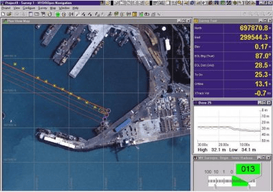
Trimble's HYDROpro™ Navigation software is an easy to use software solution for today's hydrographic surveyor. Designed with superior performance and efficiency in mind, it allows for significant improvements in productivity on even the most complex marine survey application.
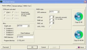
The HYDROpro Navigation software operates on Windows operating systems, and includes a flexible data acquisition and storage system that is compatible with Microsoft Access.
The software's flexible operation provides multiple steerby' capability, allowing guidance of multiple vessels and offsets to multiple guidance objects such as targets, lines, or routes. Guidance between mobile vessels is available. Any number of vessels can be monitored from a single location or across a network. Background files can be displayed graphically to show position in relation t o guidance objects, coastal features.

Enables you to keep your Nokia 500 Auto Navigation software up-to-date.
LXe is a program for communication between PC and all LX navigation products.


Comments